|
Chandler Era Vintage Maps |
||
|
|
NEW and IMPROVED Vintage Art Deco
HIGH-TECH |
|
|
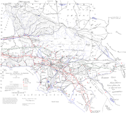
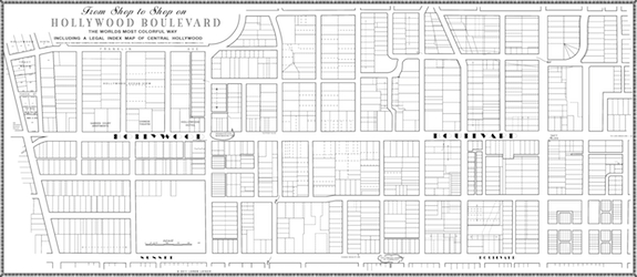
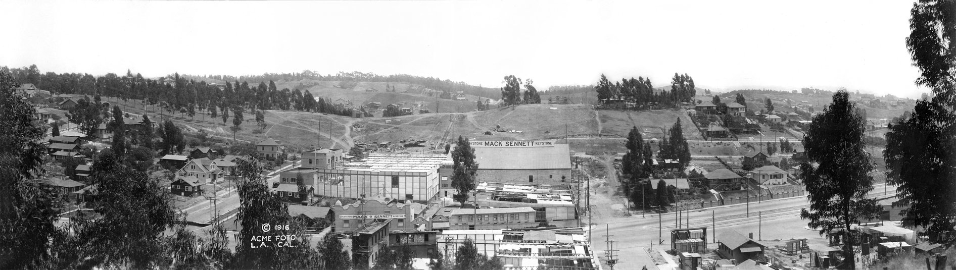
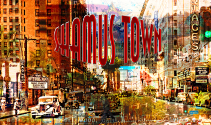
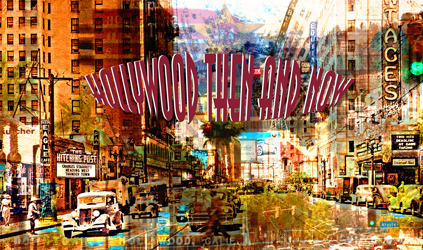
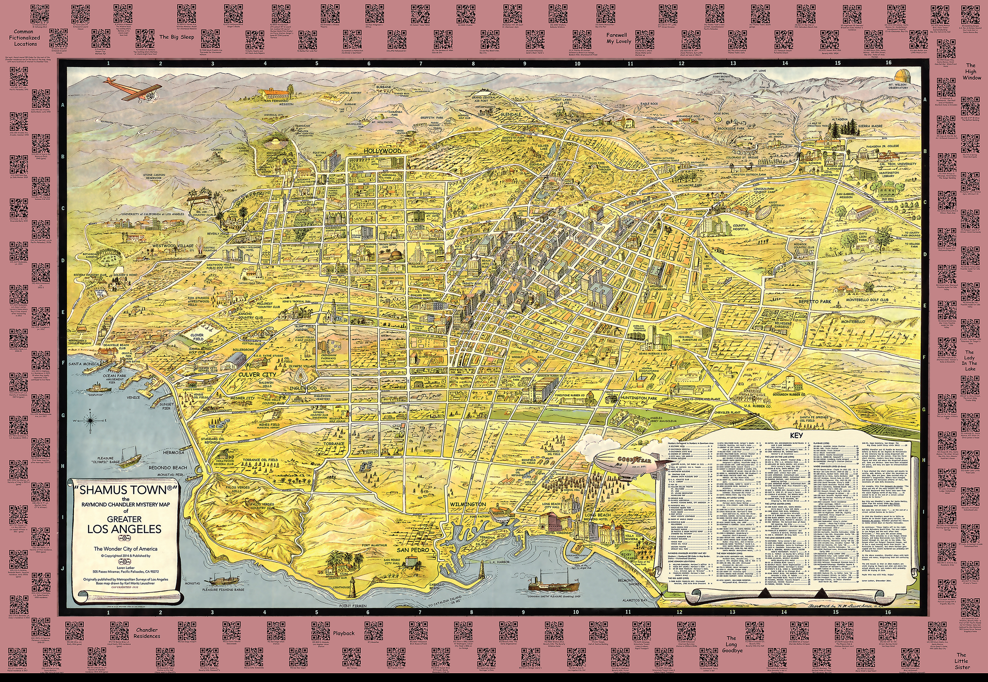
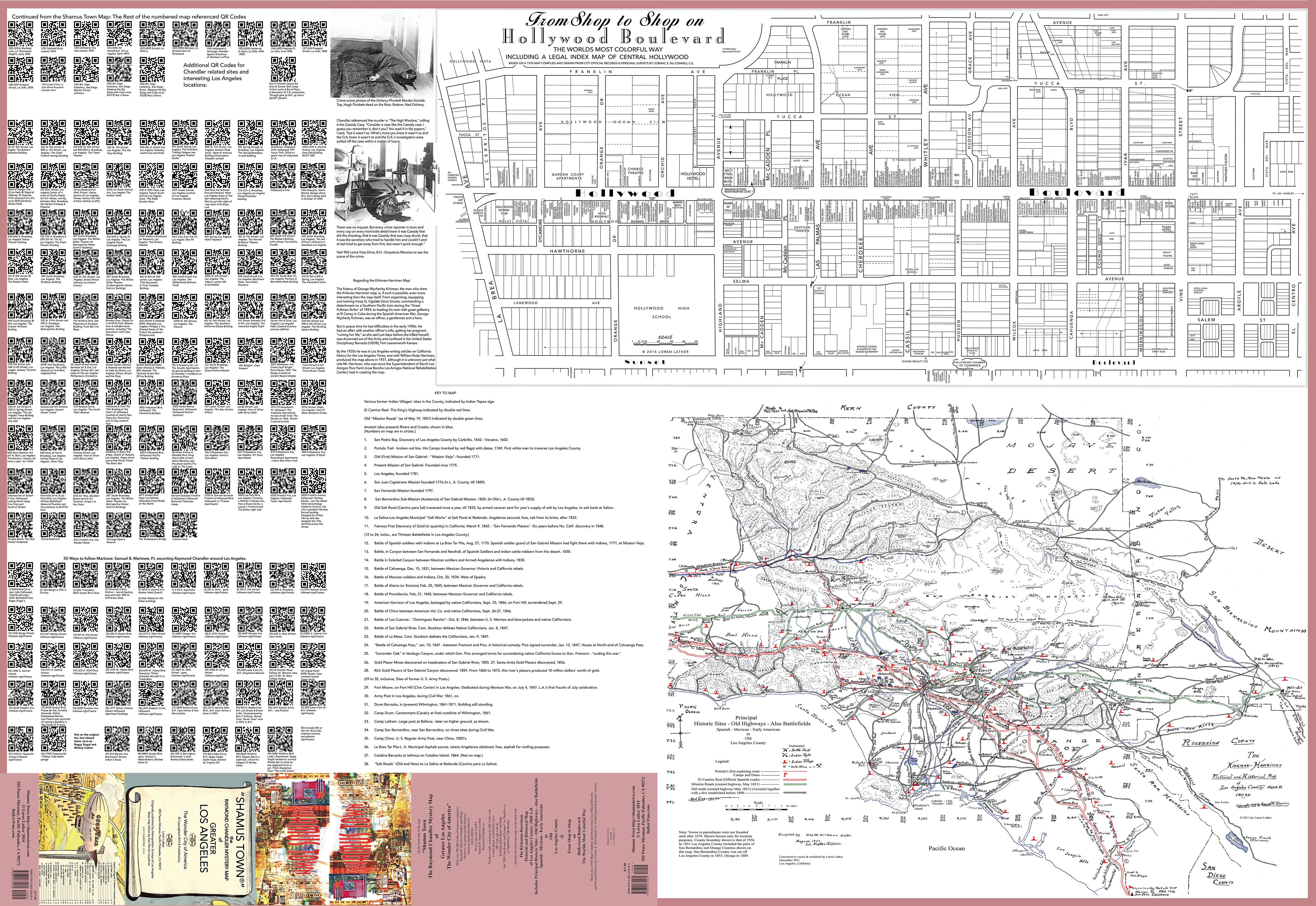
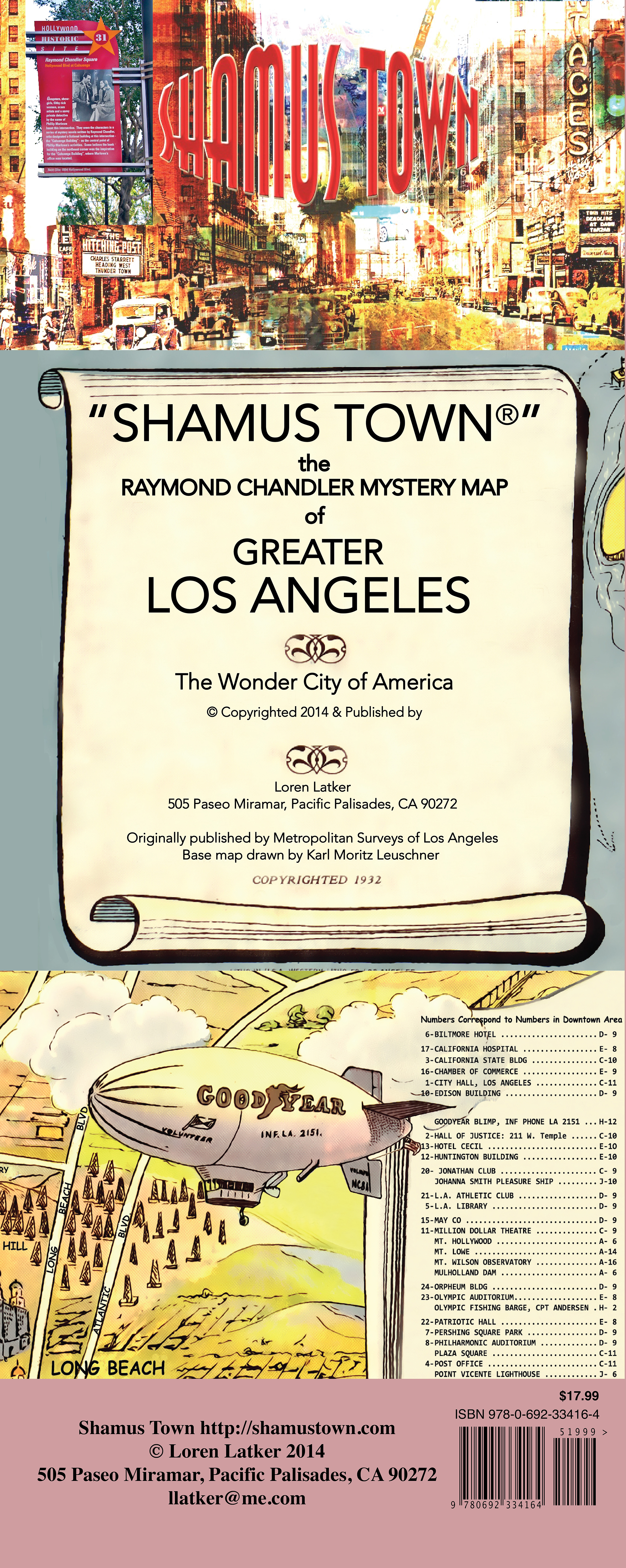
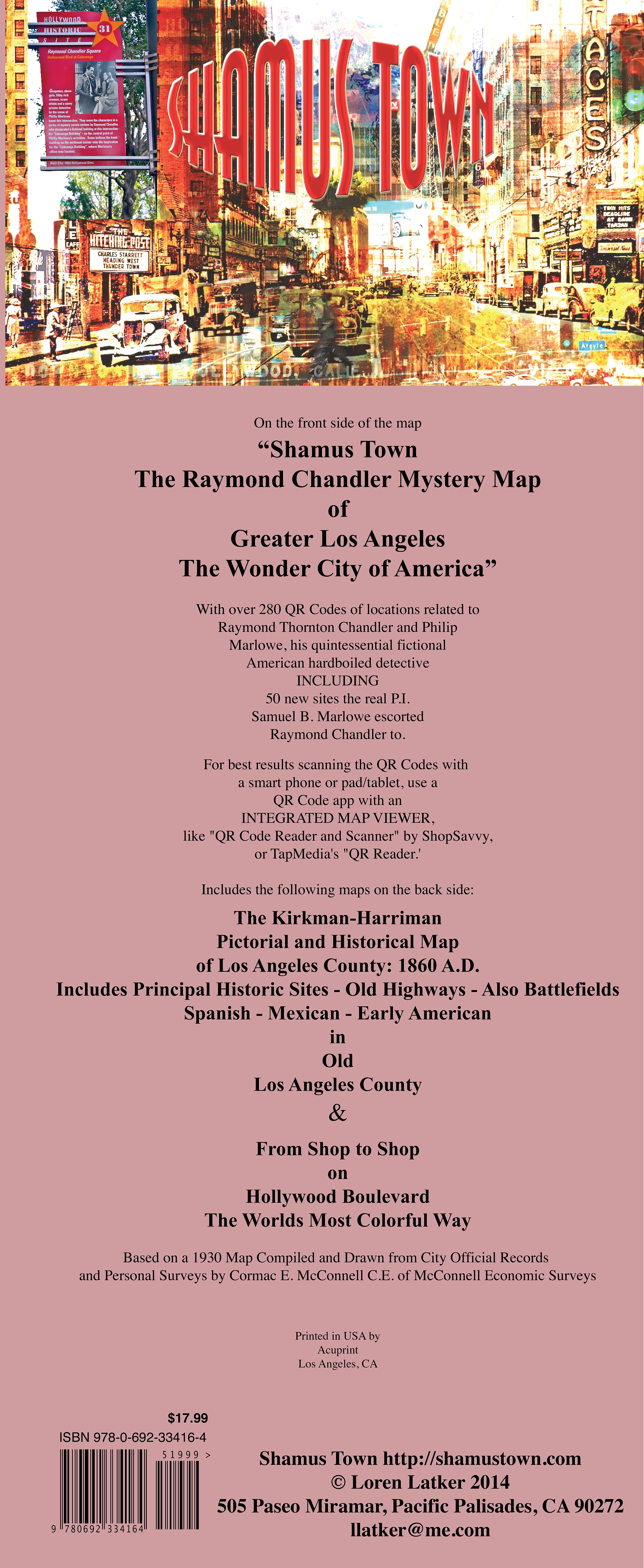
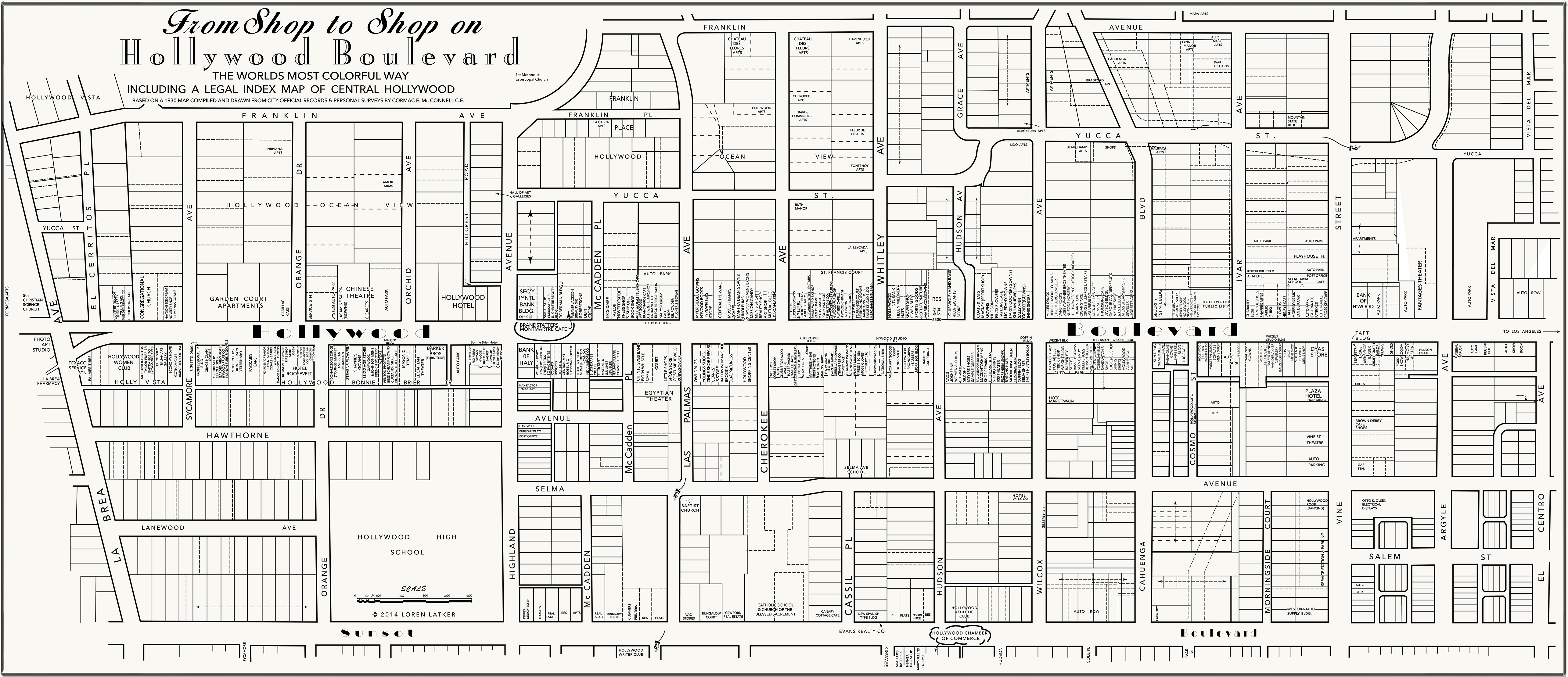
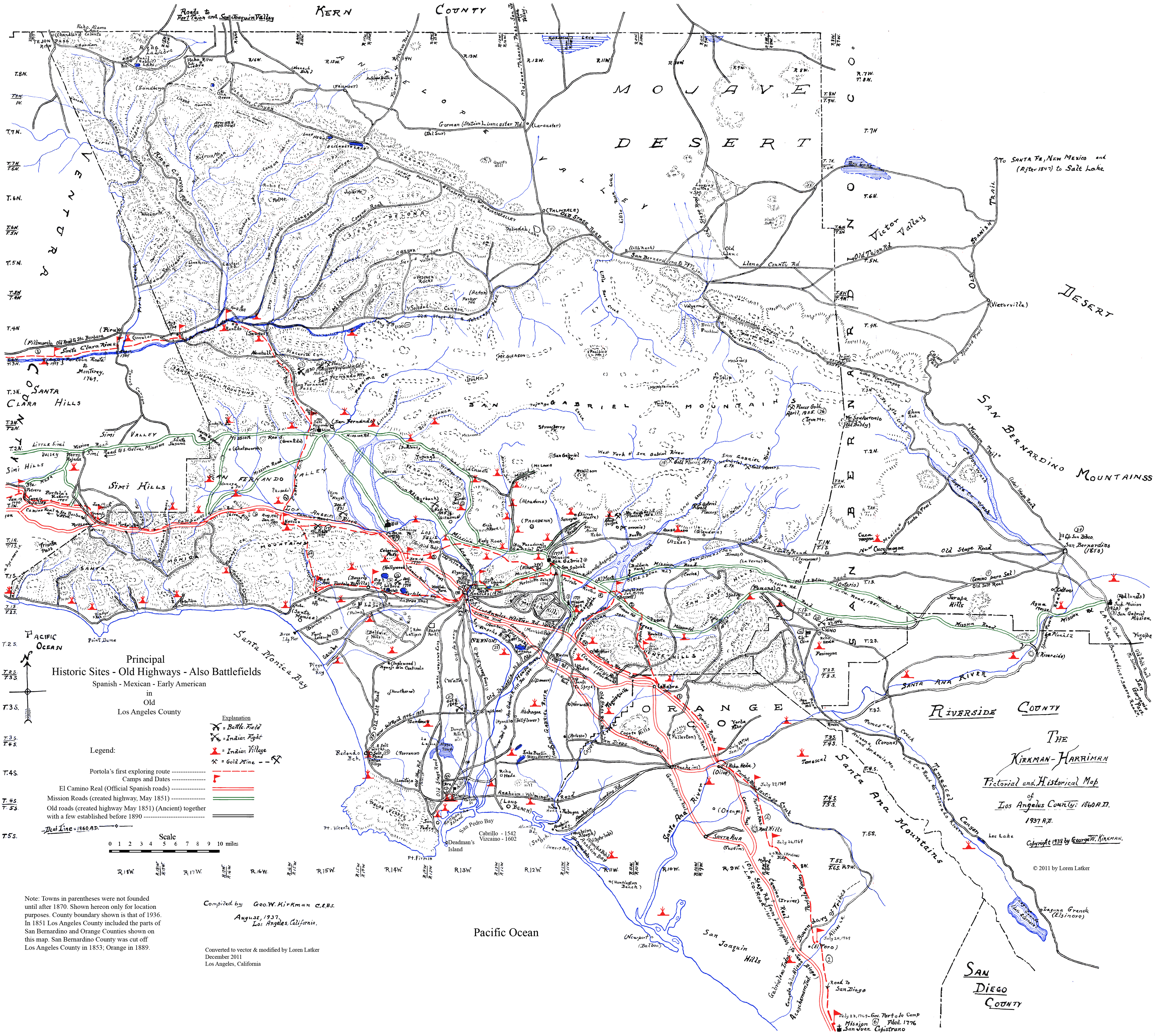
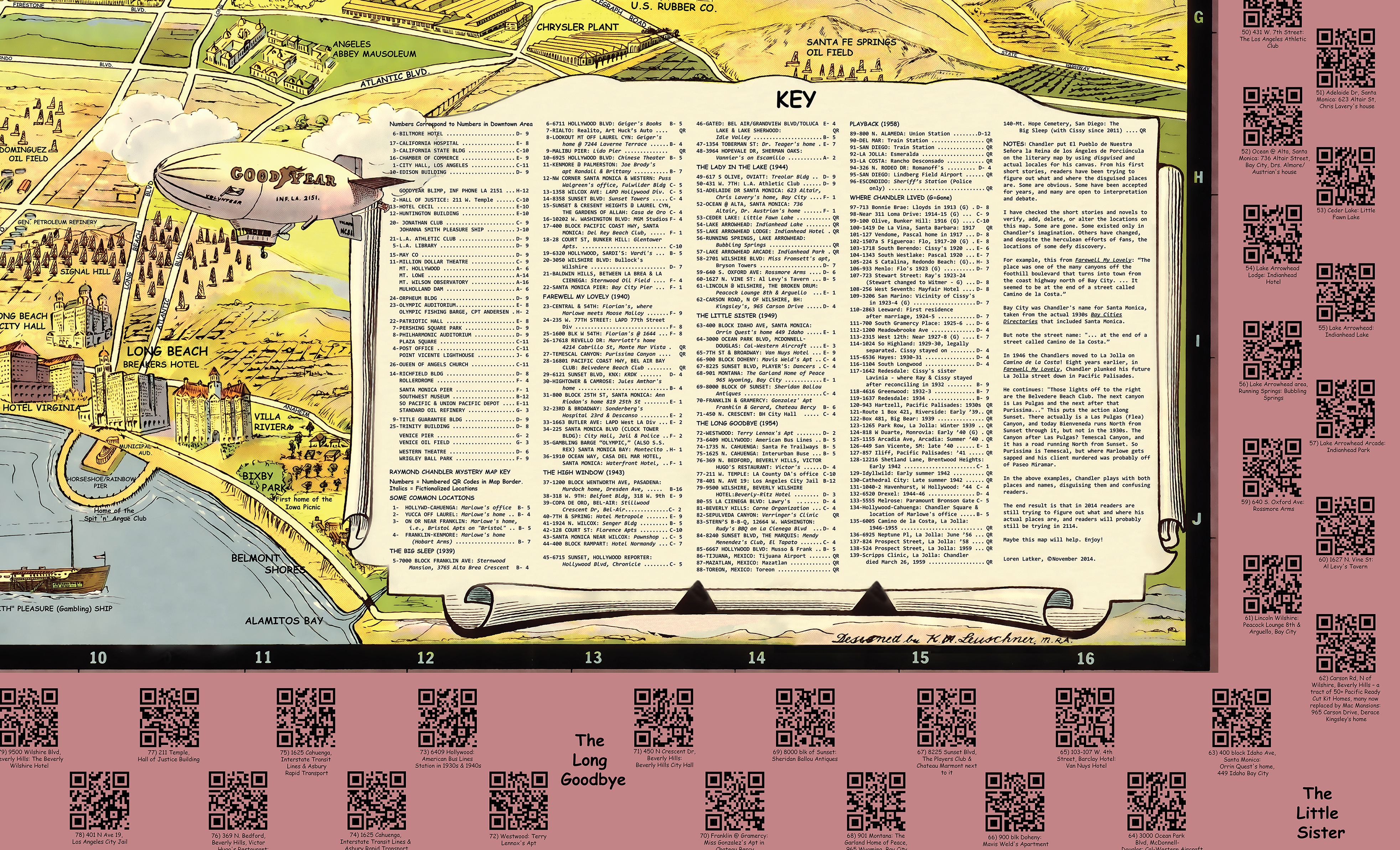
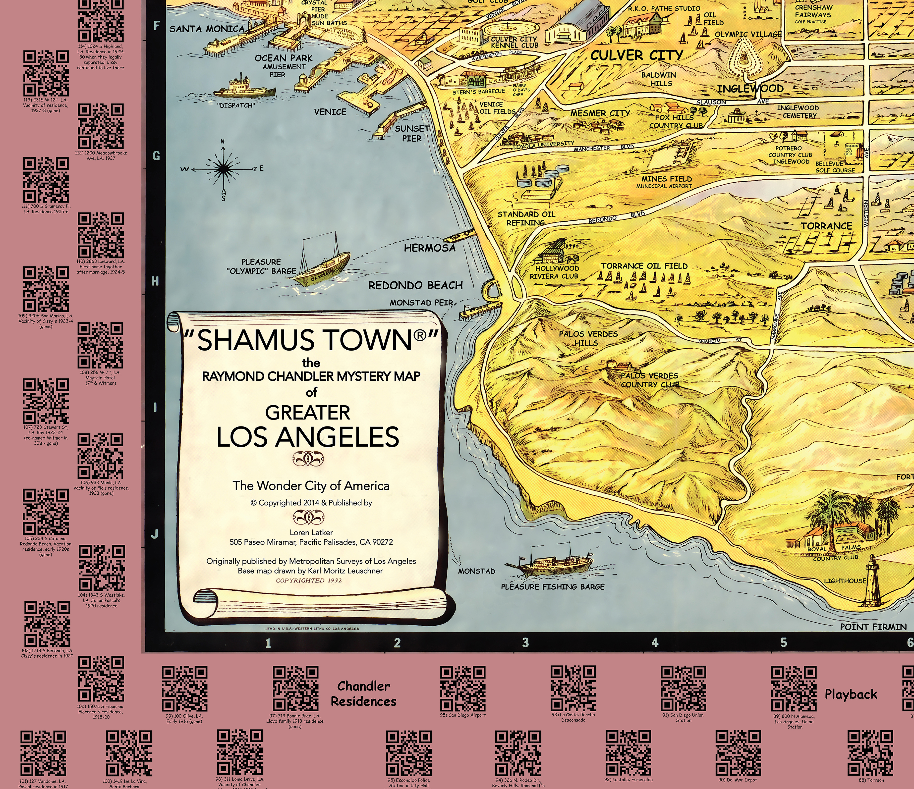
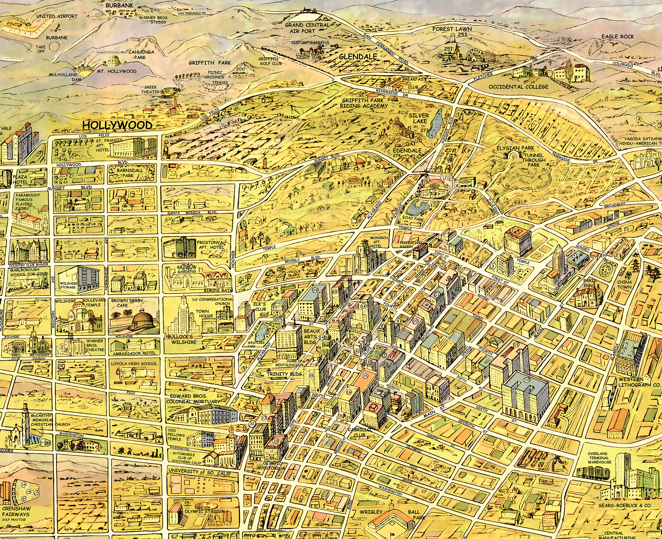
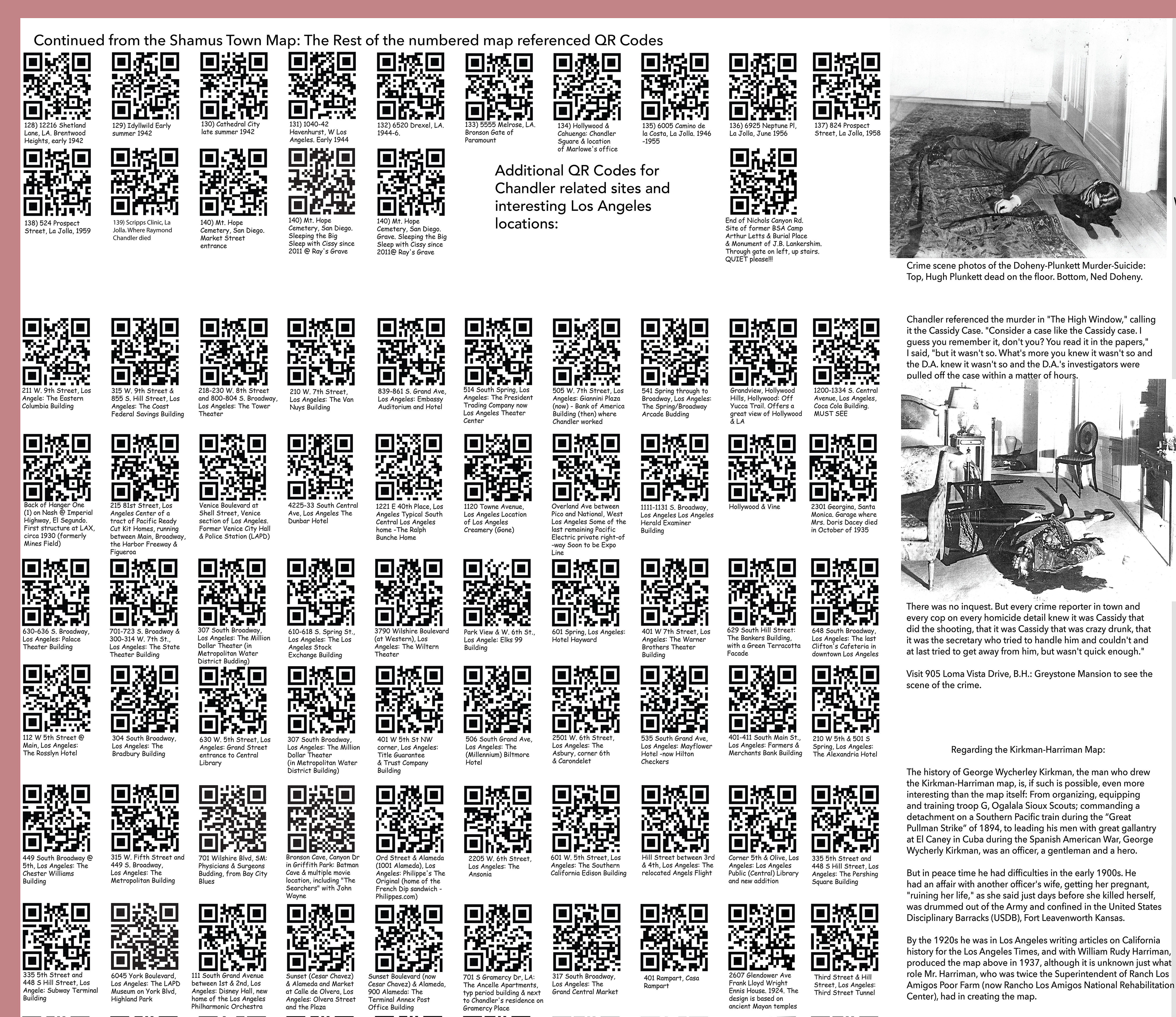
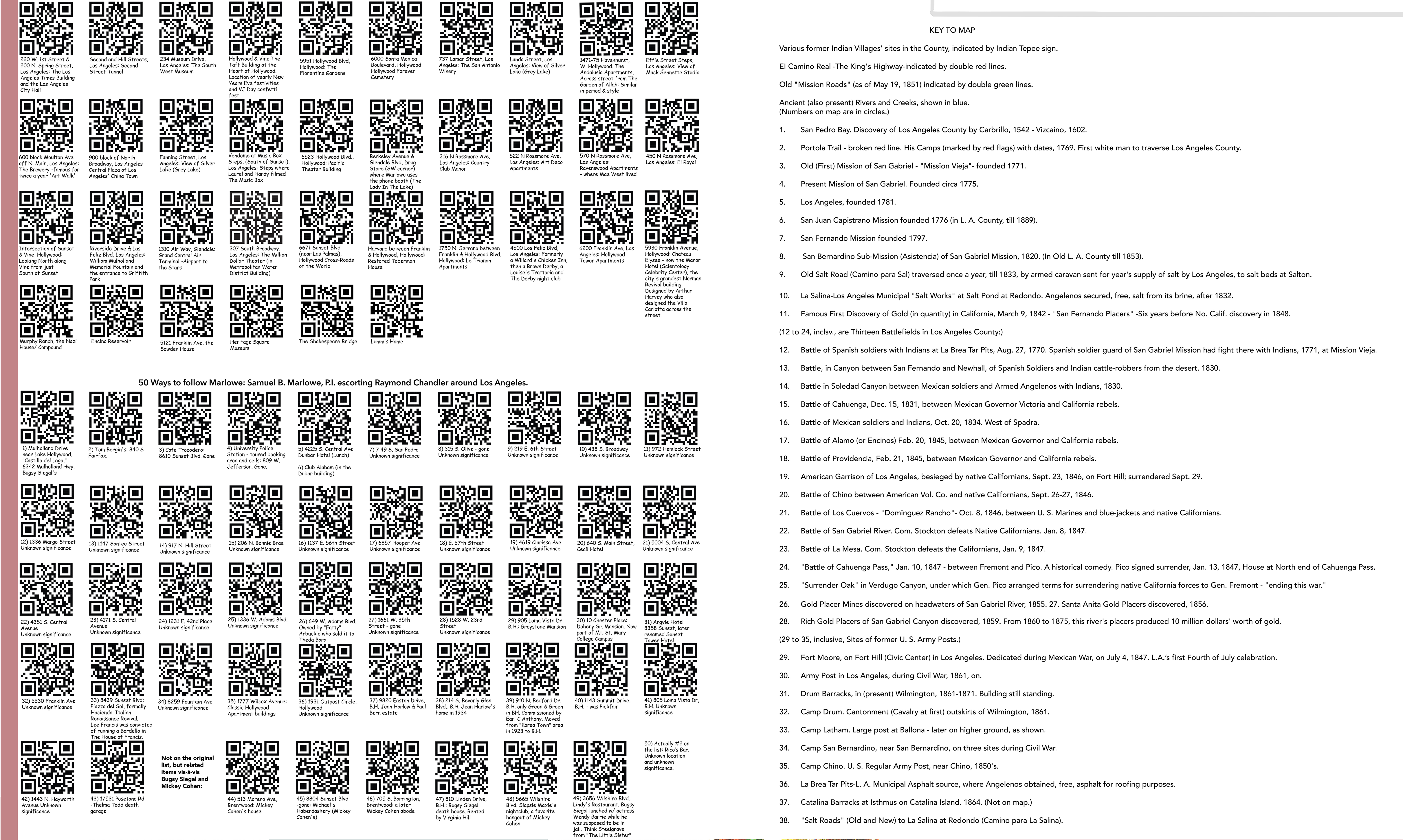
ISBN 978-0-692-33416-4 On the front of the Map The Raymond Chandler Mystery Map of Greater Los Angeles: The Wonder City of America. Based on the detective fiction of Raymond Chandler. Includes Raymond Chandler related sites in the greater Los Angeles area. A wonderful reader's companion to Raymond Chandler's detective fiction. The base map art of Los Angeles was designed and drawn by Karl M. Leuschner in 1932, and modified by Loren Latker in 2014. Leuschner was born in Berlin, Germany on Aug. 22, 1878, and was a graduate of the Berlin Royal Academy of Fine Arts. Leuschner immigrated to the U.S. in 1906, settling in New York. He graduated from Oswego Normal University and then taught art in the public schools of Rochester, NY. He moved to Los Angeles in 1926 and taught at Otis Art Institute. He earned his doctorate from UCLA while working for local lithographers (including Western Lithographers). He also developed a sophisticated color chart. He moved to San Francisco in 1936, and died there on May 30, 1940 at the age of 62. The base map "art" of The Raymond Chandler Mystery Map of Greater Los Angeles is, as described in "Los Angeles In Maps" by Glen Creason of the Los Angeles Public Library, "an attempt to paint a beautiful and tidy picture of Southland charms," in the form of a pictorial map. Such maps rose in popularity with both advertisers and the public in the 1930s, especially around the time of the 1932 Olympic Games in Los Angeles. Creason continues: "Offering the classic profile of the greater Los Angeles area, this eye-catching, wide-angle look at the metropolitan area of 'Greater Los Angeles' demonstrates an amazingly broad view of the city's recreational, industrial, and cultural vibrancy. ... As an accurate bit of cartography, the map is not even close to reality, but as a work of art it is worthy of depicting "the wonder city of America," spiced by the ... artist's playful sense of humor." "Though published in the year of the Olympics in Los Angeles, this map only minimally mentions the Olympic auditorium, the Olympic village, the understated Olympic Stadium (later Memorial Coliseum), and the Olympic rowing course. Instead there is representation of several rubber manufacturers, all gone now, including U.S. Rubber, Firestone, Goodrich, and the Goodyear plant and blimp hovering over the well-represented Long Beach. All of the oil fields can he found along the southern petroleum belt, from Venice to Torrance to mighty Signal Hill, then Dominguez and out to Santa Fe Springs. The points of interest chosen are eccentric and drawn with some reflection of the mapmaker's tastes." Leuschner's public domain map was chosen as the base for the Chandler Mystery Map because it is such a wonderful piece of art, created at around the same time that Raymond Chandler began to write detective fiction. However, in creating the modern Mystery Map, all hand written text was stripped out and the map was patched where the text had been. Other changes, corrections and additions were then made to the base art, and then all the text was replaced using a modern computer font that approximated the artists original hand lettered text. The Map Key was also enlarged, and Chandler locations were added. 287 QR Codes were then created and placed in the enlarged border, and on the backside of the map. There are 127 QR Codes on the map front and 160 on the back, showing locations related to Raymond Chandler and Philip Marlowe, his quintessential fictional American hard-boiled detective hero/Western Hero/White Knight. Also INCLUDED in the 287 codes are 50 newly discovered sites that the real P.I. Samuel B. Marlowe escorted Raymond Chandler to sometime in the 1930s. For best results scanning the QR Codes with a smart phone or pad/tablet/pablet, use a QR Code app with an INTEGRATED MAP VIEWER. On the back of the Map: The Kirkman-Harriman Pictorial and Historical Map of Los Angeles County 1860 A.D. Includes Principal Historic Sites - Old Highways - Also Battlefields. Plus, Spanish, Mexican and early American sites in Old Los Angeles County AND "From Shop to Shop on Hollywood Boulevard: The Worlds Most Colorful Way." Based on a 1930 Map compiled and drawn from City Official Records and Personal Surveys by Cormac E. Mc Connell C.E. The "Kirkman-Harriman Pictorial and Historical Map of Los Angeles County 1860 AD 1937 AD" is a rare and unique map that every child in Southern California should own and use during grades Three through Five as they study the American Indians in California, as well as the period of Spanish Exploration, the Mission period and the Mexican rule of Alta California, and the subsequent war of independence. The Kirkman-Harriman Map is also one that adults will treasure, especially those who love maps, Los Angeles and Southern California. The Map is also rare: The downtown Los Angeles Public Library has one, but few other copies are known to exist. Copyrighted in 1938, if the U.S. Copyright Office has an example, they have not made it publicly available. Changes were made to portions of the Kirkman-Harriman Map to make it more legible. The history of George Wycherley Kirkman, the man who drew the map, is, if such is possible, even more interesting than the map itself: From organizing, equipping and training troop G, Oglala Sioux Scouts, commanding a detachment on a Southern Pacific train during the "Great Pullman Strike" of 1894, to leading his men with great gallantry at El Caney (7/1/1898) in Cuba during the Spanish American War, George Wycherly Kirkman, was an officer, a gentleman and a hero. But in peace time he had difficulties in the early 1900s: He had an affair with another officer's wife, getting her pregnant, and "ruining her life," as she said just days before she killed herself. He was courts-martial twice for the same conduct unbecoming offense drummed out of the Army and confined to the United States Disciplinary Barracks (USDB) at Fort Leavenworth, Kansas. He petitioned for early release but was denied. By the 1920s he was in Los Angeles writing articles on California History for the Los Angeles Times, and with William Rudy Harriman, produced his map in 1937, although it is unknown just what role Mr. Harriman, who was twice the Superintendent of Rancho Los Amigos Poor Farm (now Rancho Los Amigos National Rehabilitation Center), had in creating the map. The "From Shop to Shop on Hollywood Boulevard: The Worlds Most Colorful Way." map is based on a 1930 Map compiled and drawn from City Official Records and Personal Surveys by Cormac E. McConnell C.E., of McConnell Economic Surveys. Not much is know, nor written about Cormac Edward McConnell. He was born in Lancashire, West Derby Ireland on October 20, 1894, and died in Costa Mesa, California on March 22, 1979. In between he became a Civil Engineer and formed his own company, McConnell Economic Surveys. His company was primarily concerned with providing economic development surveys in the City of Los Angeles and southern California: Los Angeles and Orange counties; various counties throughout California; Nogales, Arizona; and Reno, Nevada, from the 1920s to the 1970s. The surveys were conducted by McConnell on behalf of various businesses and other entities in order to anticipate construction costs and the likely profitability of business situated in a specified geographic space. The bulk of the McConnell Economic Survey collection is now in the Library of Congress, and presumably in the Public Domain. However, the library has not put any of the material online and the material can only be viewed in a Library of Congress reading room. Shamus Town was able to obtain a high resolution scan of McConnell's Hollywood Boulevard map. However, the scan picked up so much of the linen fabric pattern that the scan was unusable and the entire map had to be recreated anew. In so doing many of the less interesting technical feature, like the interior dimension of individual stores, etc., were left out. In addition to the two maps and 160 QR Codes, the back of the map contains the map covers, the Key to the Kirkman map, the above description of George Wycherly Kirkman, and two vintage crime scene photos from the Doheny murder-suicide case and a quote from Chandler's High Window about "The Cassidy Case," which is what Chandler called the Doheny case. The Raymond Chandler Mystery Map of Greater Los Angeles is 2 sided full color 26" x 39." The map folds down to 28 4x10" panels (or pages) in a standard Gas Station road map size. The map is shipped folded in a #11 clear, USPS approved, sleeve. $22.99 (free shipping and handling). 9% sales tax will be added to California purchases. Also available is a unfolded flat version of the map which is shipped rolled in a plastic sleeve in a tube. The cost for that map is also $22.99. The front side modern original map art was designed at 160" x 110", or 13 x 9 feet. The folded map is printed at 25%. A full size 13x9 foot map is available by special order. Smaller versions of the map are also available: Keep in mind that while the smaller sized printed maps will look good, they will probably require the use of a magnifying glass to read any text and/or see any details. Purchase either the flat or folded two sided map below: |
||
|
|
|||||||||||||||||||||||||||||||||||||||||||||||||||||||||||||||||||||||||||||||||||||||||||||||||||||||||||||||||||||||||||||||||||||||||
|
|||||||||||||||||||||||||||||||||||||||||||||||||||||||||||||||||||||||||||||||||||||||||||||||||||||||||||||||||||||||||||||||||||||||||
|
|||||||||||||||||||||||||||||||||||||||||||||||||||||||||||||||||||||||||||||||||||||||||||||||||||||||||||||||||||||||||||||||||||||||||